
New Zealand has some of the most epic landscapes that you will find. For an outdoors lover like me, it was a dream destination.
We spent 7 days in New Zealand and did at least one hike every day. Unfortunately we didn’t have time to do any of the Great Walks, but in New Zealand there is no shortage of epic day hikes.
I’ve teamed up with other travel bloggers to share with you all the coolest hikes in New Zealand that you can do in a day.
If you’re looking for the best day hikes in New Zealand, this is the guide for you.
Contents
- 1 Best day hikes in South Island, New Zealand
- 1.1 Hooker Valley Track, Mount Cook / Aoraki National Park
- 1.2 Mueller Hut
- 1.3 Red Tarns Track, Mount Sebastopol
- 1.4 Roy’s Peak, Wanaka
- 1.5 Rob Roy’s Glacier, Wanaka
- 1.6 Tiki Trail, Queenstown
- 1.7 Queenstown Hill
- 1.8 Mount Arthur
- 1.9 Avalanche Peak Route, Arthur’s Pass
- 1.10 Mount Robert Circuit
- 1.11 Mitchells Track in the Sugarloaf Reserve, Christchurch
- 1.12 Mount John Summit, Lake Tekapo
- 2 Best day hikes in North Island, New Zealand
- 3 What to bring on your day hikes

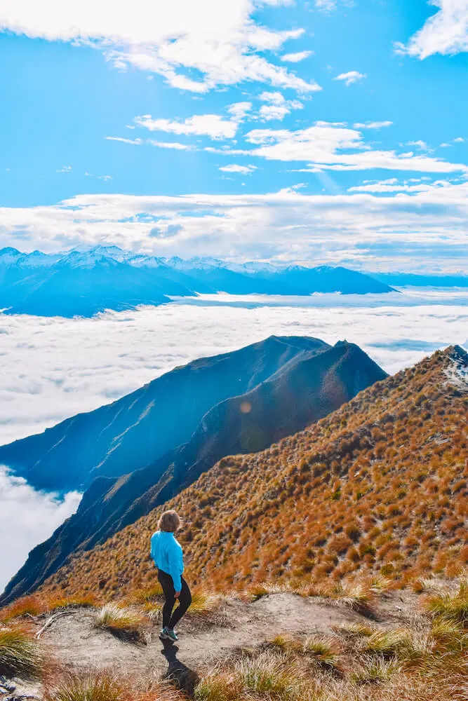
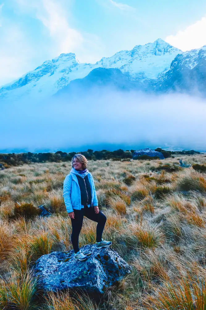
View from the top of Roy’s Peak, New Zealand
Best day hikes in South Island, New Zealand
Hooker Valley Track, Mount Cook / Aoraki National Park
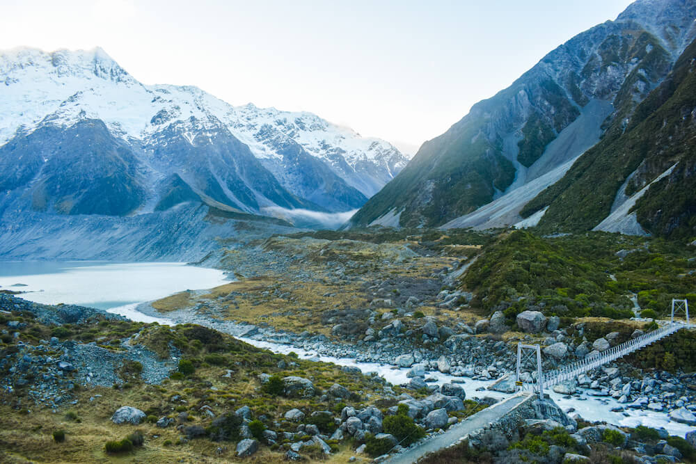
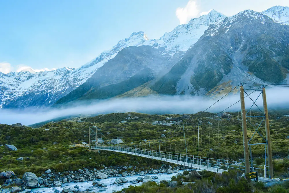
Hooker Valley Track in Mount Cook / Aoraki National Park is one of the most famous and popular hikes in New Zealand.
The hike is a 10km return trip but with no elevation, the fact that it’s so flat and relatively easy makes it accessible to pretty much all levels of hikers.
The start of the track is a short 10-minute drive out of Mount Cook Village, by the White Horse Hill Campground. It’s also the starting point of other hikes so make sure you check the signs and get on the right trail.

Hooker Valley Track in Mount Cook National Park, New Zealand

Hooker Valley Track in Mount Cook National Park, New Zealand
The hike is pretty long but the terrain is well beaten and it’s not particularly challenging.
The trail takes you through Hooker Valley, across suspended bridges and ends at Hooker Lake, where you will see icebergs floating in the water of the lake.
The valley is surrounded by snow-capped mountains that make it a very scenic walk. We took a lot of breaks during the hike and it took us around 4 hours to complete it.
| READ MORE: ULTIMATE GUIDE TO HIKING HOOKER VALLEY TRACK |

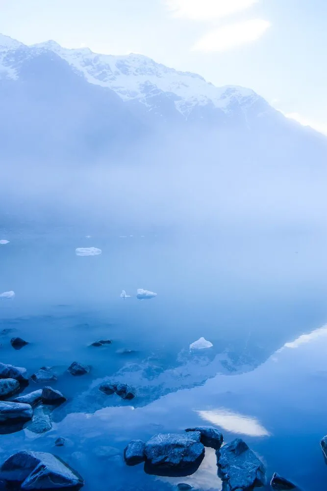
Hooker Lake with the icebergs floating in it
Mueller Hut
“One of the best day hikes in New Zealand is the hike to Mueller Hut. You can also extend it, as the hut provides beds, but it is also the perfect candidate for a one day adventure.
It will take you approximately 3 to 4 hours to go up to the hut which sits at around 1,800m and then another couple of hours to return.
The trek starts from the White Horse Hill, car parking close to Mt. Cook Village, around 2.5 hours drive from Wanaka. It is not a challenging trek, but you will face an exhausting set of no less than 1806 stairs.
But don’t worry, the views over New Zealand’s tallest mountain, Mount Cook, will help you fight the pain in your legs and get you on top. After the stairs, you have to pass some big rocks, and you are almost there.
Enjoy a cup of tea at the red Mueller Hut offering incredible views over the mountains and then head back down on the same route!”
– by Andra, Our World to Wander


Mount Cook as seen from the trail, photo by Our World to Wander
Red Tarns Track, Mount Sebastopol
“My favourite day hike in Aoraki/Mount Cook National Park is without a doubt the 2 hour return Red Tarns Track to an unforgettable viewpoint on Mount Sebastopol.
The track itself is relatively easy, with steps guiding the way of this 3.5km walk. It is, however, quite steep so if you easily get sore knees, remember to bring trekking poles!
Starting from Mount Cook Village, cross the river and begin the walk coiling up around the mountainside. Due to the weather and season we visited, we found lots of fresh snow on the track.


Reflections at Red Tarns Track, photo by Suzy Stories
The white blanket made for an incredible landscape, the snow-capped peaks sparkling in the sun. Although be careful to avoid any slips on frosty patches!
Once we reached the lookout overlooking the village we had stunning panoramic views of Aoraki/Mount Cook straight ahead – pretty darn amazing if you ask me!
A brief walk around the tarns, we saw a perfect reflection of the mountains around us in the reddish waters.
Before long, we began our descend, fortunately with more melted ice to make the walk easier, and still with breathtaking views all around.”
– by Suzy, Suzy Stories


Mount Cook Village from Red Tarns, photo by Suzy Stories
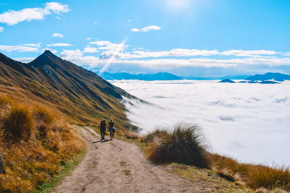
Roy’s Peak, Wanaka
Roy’s Peak in Wanaka is the hardest hike I’ve ever done, but the view at the top is well worth the effort. The hike is a 16km return track with a 1.2km incline that takes around 5 to 6 hours. The trail starts just outside Wanaka.
I was there in May so it wasn’t too crowded and we could park our car in the parking lot at the start of the hike.
However if you’re visiting in summer they often recommend to park in Wanaka and then cycle or walk there as the parking lot is quite small and it can get full early on.

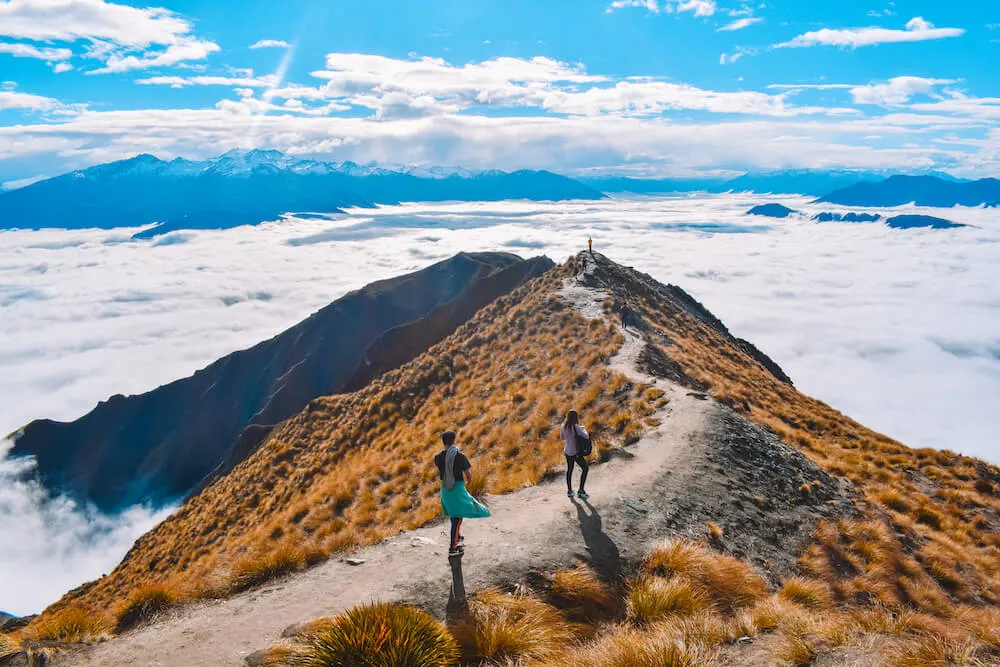
View from the top of Roy’s Peak, New Zealand
The path is well beaten and easy to walk on, but it’s also constantly at an incline. At no point during the hike you will find yourself walking on flat ground.
This obviously makes it a pretty tiring hike on the way up, but also challenging on the way down as it can be tough on the knees. There is a viewpoint after 6.5km where we ended up stopping.
We did Roy’s Peak after a few days of hiking already and the final 1.5km to the peak was a bit too much. The view over the surrounding mountain peaks was awesome also from the first viewpoint so we decided it was good enough for us.
We were a bit unlucky as we were visiting on a cloudy day and we couldn’t see the lakes and valleys below us, however the view of the snowy mountain peaks breaking through a blanket of clouds was very beautiful too.

Hiking up Roy’s Peak, New Zealand
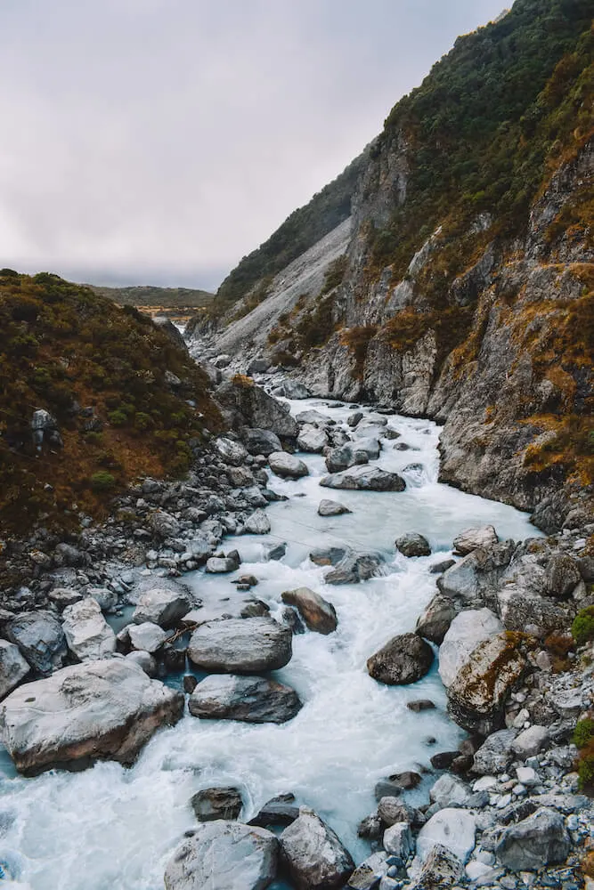
Rob Roy’s Glacier, Wanaka
“Rob Roy’s Glacier is one of the best hiking trails in Wanaka and all of New Zealand for that matter. The trail is much less talked about than the Insta-famous Roy’s Peak, but perhaps even more scenic.
The trail starts 54km to the west of Wanaka in the Mount Aspiring National Park. Don’t let the distance fool you, the small unsealed and badly potholed road takes at least 1.5hrs to drive each way.


Rob Roy’s Glacier, photo by The Lost Passport
The walk is 10km total and takes about 4-5hrs round trip, allowing for some time at the top to admire the glaciers. A moderate difficulty hike leads to a lower glacier lookout, and an upper glacier lookout.
It is definitely wise to continue to the upper lookout for the most incredible views.
Once you stand up the top surrounded by glaciers and waterfalls, you will understand why Rod Roy’s Glacier is really one of New Zealand’s best day hikes.”
– by Josh Shephard, The Lost Passport


Rob Roy’s Glacier, photo by The Lost Passport
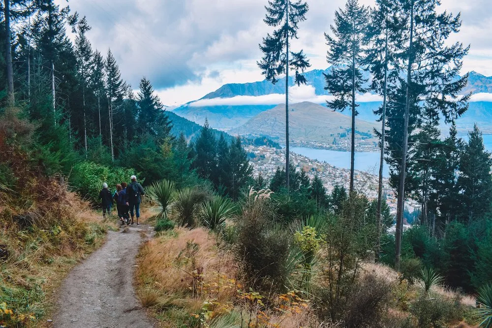
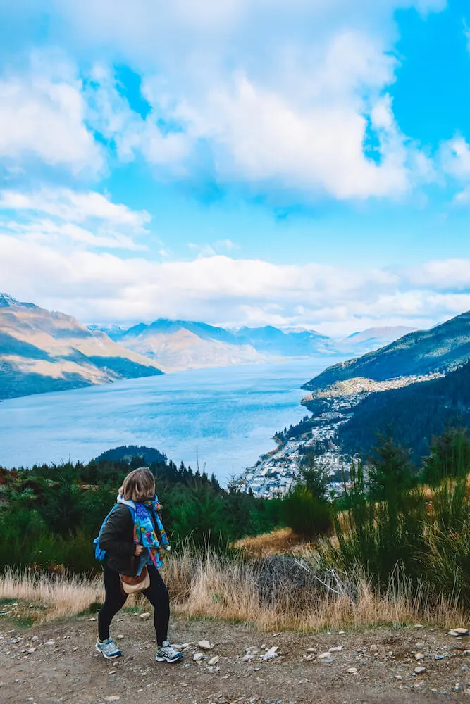
Tiki Trail, Queenstown
The Tiki Trail in Queenstown takes you to the top of Bob’s Peak, which is also where the Queenstown Skyline gondola arrives. Bob’s Peak has a beautiful view over Queenstown, the lake and the surrounding mountains.
To get to the peak you can either pay 50 NZD for a return trip with the gondola, or hike for 30 minutes on the Tiki Trail.
The Tiki Trail is only about a 1.6km trail, with a 400m incline and the return trip should take around 1 hour in total.
Despite being a short hike it’s actually very intense as it’s very steep and the trail isn’t well beaten. At times you will even find yourself climbing over logs and rocks.
I personally thought it was quite fun as it made it more challenging than being just a walk, but make sure to be ready for it.
I did the hike on a cloudy day so unfortunately I didn’t get to see any of the view, but we managed to see glimpses on our way back down the Tiki Trail and it seemed great.

Views over Queenstown from the Tiki Trail
Queenstown Hill
Another very popular hike in Queenstown is Queenstown Hill. This hike starts on the other side of Queenstown relative to the Skyline and Tiki Trail base.
The trail starts off as a single route, but then divides in two options; a longer but flatter one, and a shorter but steeper route.
Both route join again at the “Basket of Dreams”, a metal sculpture from which you can admire the view over Queenstown.
After the “Basket of Dreams” there is another short additional steep section that takes you to the peak. From here you will have 360° views over both Queenstown and the mountains and valleys on the other side.
Depending on which route you choose the hike is between 1.7km and 2.5km and can take anywhere between 1.5 and 3 hours.
| READ MORE: EVERYTHING YOU NEED TO KNOW ABOUT HIKING QUEENSTOWN HILL |

Hiking up Queenstown Hill, New Zealand


Mountain views from Queenstown Hill, New Zealand
Mount Arthur
“Mt Arthur is located around an hour drive from Nelson city. Located in Kahuranga National Park, Mt Arthur is popular for the high chances of meeting a kiwi bird.
To get there, it is preferable to have your own transportation. The hike alone isn’t difficult, but requires you to walk along the ridge for almost the entire hike.
There will be a little stone climbing and ice boulder climbing before reaching the summit, so prepare yourself with trekking poles if possible.
The views along the ridge is what makes it unique but beware of the strong winds. It can hit up to 80 km/h sometimes.
Time requires would be around 4 to 5 hours. Hikers often chose to stay overnight at the Mt Arthur Hut as kiwi birds usually come out at night. Highly recommended if you’re traveling at the northern part of South Island, New Zealand.”
– by Yen, Swing Abroad


Mt Arthur, photo by Swing Abroad
Avalanche Peak Route, Arthur’s Pass
“The Avalanche Peak Route is ideal for awesome views of the Arthur’s Pass valley and the surrounding mountains. On this full day hike you might even be lucky enough to see the kea up close.


The kea up close, photo by Magnetic Voyage
The Department of Conservation classifies this track at the ‘Expert’ level. That might be the case, if the conditions are not great.
Otherwise, with a normal level of fitness, the Avalanche Peak at 1833m is easy to reach after 3 to 4 hours of hiking.


Arthur’s Pass, photo by Magnetic Voyage
The Avalanche Peak Track starts behind the visitor centre in Arthur’s Pass village. The last part of the way is marked with poles as it could be quite hard to find otherwise.
For a round way track, which ends just a few hundred meters next to the starting point, take the Scotts Track down. The Scotts Track is easier, but not as impressive, so it is perfect for the return trip.”
– by Kaia, Magnetic Voyage


Arthur’s Pass, photo by Magnetic Voyage
Mount Robert Circuit
“Located in Nelson Lakes National Park on New Zealand’s South Island the 9 kilometre long, Mount Robert Circuit is a great short walk. Paddy’s track is reasonably exposed but mainly well formed.
As you hike up you’ll get stunning views of the beautiful Lake Rotoiti. This tramp is part of the Angelus Hut tracks if you want to take a longer walk. The route is well served by local campsites and the Bushline Hut.
We would advise against this route in adverse weather as it is pretty exposed the circular route took us 2 hours and 30 minutes including rest stops, however, the New Zealand DOC estimates that this is a 5 hour tramp.
You won’t want to miss the historic KEA hut which is on the Mount Robert Circuit and which was built by skiers in 1931.”
– by Sarah Carter, ASocialNomad


Mount Robert Circuit Kea Hut, photo by ASocialNomad
Mitchells Track in the Sugarloaf Reserve, Christchurch
Considering this hike is located a short 30-minute drive outside of Christchurch, I was amazed at how good the views were.
The Sugarloaf Scenic Reserve is famous for the 120m television transmission tower that tops it, and for being a popular hiking location in Christchurch.
While we were hiking on Mitchells Track we came across lots of other people walking, hiking or cycling in the area. Mitchells Track is a 2.5km full circuit that should take around 1 hour.
The views are pretty incredible though so if you’re like me, you might want to schedule in some time for taking photos and just sitting and enjoying the view.
It’s not a particularly steep trail but in certain sections it’s not particularly well beaten so it can be a bit muddy and slippery. Mitchells Track and a lot of other hikes in the Sugarloaf Reserve start at “The Sign of the Kiwi” coffee shop.
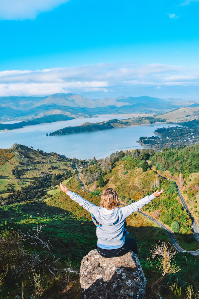
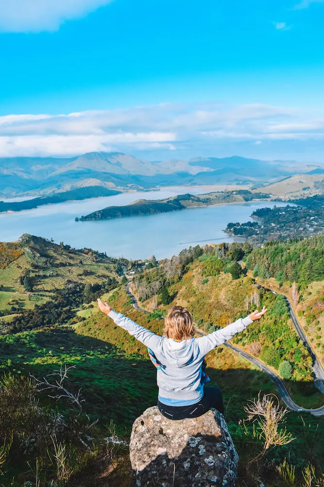
Enjoying the view from the peak of the Sugarloaf, New Zealand
Mount John Summit, Lake Tekapo
With its distinctive turquoise water Lake Tekapo is one of the most famous destinations in New Zealand.
There are a number of hikes that you can do around the lake, however the best one in my opinion is Mount John Summit via the lakeshore.
This trail is divided in a steep section in the woods, where you’re surrounded on all sides by typical New Zealand forest trees, and a more gradual slope in the open tussock hill slopes.
The section walking in the woods is more picturesque, but the walk in the open hills offers stunning views over Lake Tekapo and the surrounding landscape.
The hike starts from Tekapo Springs and is an 8km full circuit, which should take around 3 hours.
Despite the low clouds that were covering the surrounding mountains the view from Mount John was still pretty epic. At the top of Mount John there is also a coffee shop where you can buy food and water.
| READ MORE: ULTIMATE GUIDE TO HIKING MT JOHN SUMMIT, LAKE TEKAPO |

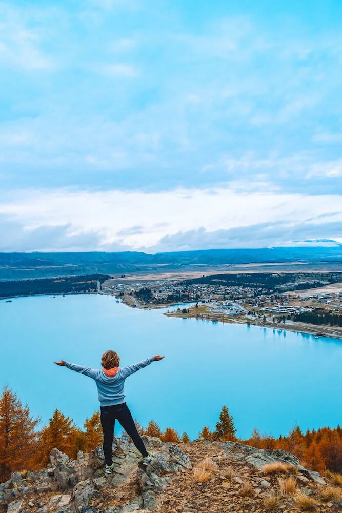
The view over Lake Tekapo from Mt John Summit, New Zealand
Best day hikes in North Island, New Zealand
City to Sea
“The City to Sea Walkway starts in the heart of central Wellington near Parliament and ends at the south coast, 12km away in Island Bay.
I usually break this up into two walks; one from the Botanical Gardens to Newtown (3 hours) and then from Newtown to Island Bay (3 hours).
Along the way you walk through the Botanic Gardens, two historic cemeteries, the famous cable car, and end with spectacular view of the ocean and Cook Strait.
On a clear day you can even see the South Island. There are parts of the walk that are uphill but the track is well maintained.
This walk starts in the centre of town near the Parliament and the Railway Station. You then end in Island Bay along the south coast and can take the number 1 bus back into town.”
– by Nicole, Travelgal Nicole


City to Sea Walkway, photo by Travelgal Nicole
Tongariro Alpine Crossing
“The Tongariro Alpine Crossing is considered to be one of the best day hikes in the world for its fascinating and varied landscape.
The length of the trail is a little bit less than 20 km, but it goes through a volcanic terrain, where walkers are exposed to weather conditions that can easily change suddenly and become harsh.
Although you can also do the Tongariro Crossing in winter, in most cases you will need to be equipped with crampons at least.


View of Mount Ngauruhoe in the winter Tongariro Alpine Crossing, New Zealand. Photo by Surfing the Planet
The main highlights of the walk are the multiple volcanic craters of Mount Tongariro. The most impressive is the Red Crater, the highest point of the track.
The views from there are simply astonishing and include Mount Ngauruhoe (Mount Doom for Lord of the Rings lovers), the large Central Crater and the Emerald Lakes.
Although there’s a parking place at both ends of the trail, it’s recommended to take a shuttle bus from Whakapapa village to Mangatepopo, where the trail starts.
From the end point in Ketatahi, you can use the same shuttle bus to get back to Whakapapa.”
– by Gábor Kovács, Surfing the Planet


View from the Red Crater in the winter Tongariro Alpine Crossing, New Zealand. Photo by Surfing the Planet
What to bring on your day hikes
Since all the hikes listed in this roundup are day hikes the amount of gear you might need is limited compared to overnight hikes. However you still want to make sure you have a day hike packing list ready.
Some of the things I brought hiking with me in New Zealand include:
Hiking boots: For most of these hikes you will want a good pair of hiking or outdoors boots. The hiking trails can be pretty tough and especially with rain or snow you want to make sure your feet are dry and warm.
Power bank: The trails are usually well marked but I find myself often relying on my phone and GPS to track my location and how long there is left to go.
Considering how quickly phones run out of battery these days it’s a good idea to bring a power bank to charge your phone on the go, so that you can avoid getting stranded on top of a mountain.
I personally use a solar charger so that it can keep charging on the go.

Hooker Valley Track, New Zealand
Waterproof jacket: The weather in New Zealand can be unpredictable, depending on the time of year that you’re visiting.
We were quite lucky with the weather but it occasionally drizzled a bit while we were half way up a hike. As you can imagine mountains don’t offer the best shelter from the rain so it’s better to have a jacket that will keep you dry. I
f you’re looking for advice on what to pack for your New Zealand trip, you can check my Iceland summer packing list (different country I know, but similar weather).
Lots of food and water! I always underestimate how thirsty I get while hiking and often don’t bring enough water. Make sure to pack plenty of water and snacks so you can refuel during the hikes.

Hiking in Hooker Valley Track in Mount Cook National Park, New Zealand
Final thoughts on the best hikes in New Zealand
Have you been hiking in New Zealand? How did you find it? Let me know in the comments below!
If you’ve done a cool day hike in New Zealand that isn’t listed here let me know, I’d love to include your recommendations!
This is a guide compiled based on day hikes I have done myself and suggestions from other travel bloggers. These are some of the best hikes in New Zealand that you can do in one day.
I hope you find it useful in planning your own New Zealand hikes.
If you’re looking for more New Zealand outdoors adventures check out my guide to cruising in Milford Sound.
Enjoyed reading about the best day hikes in New Zealand? Pin it!


